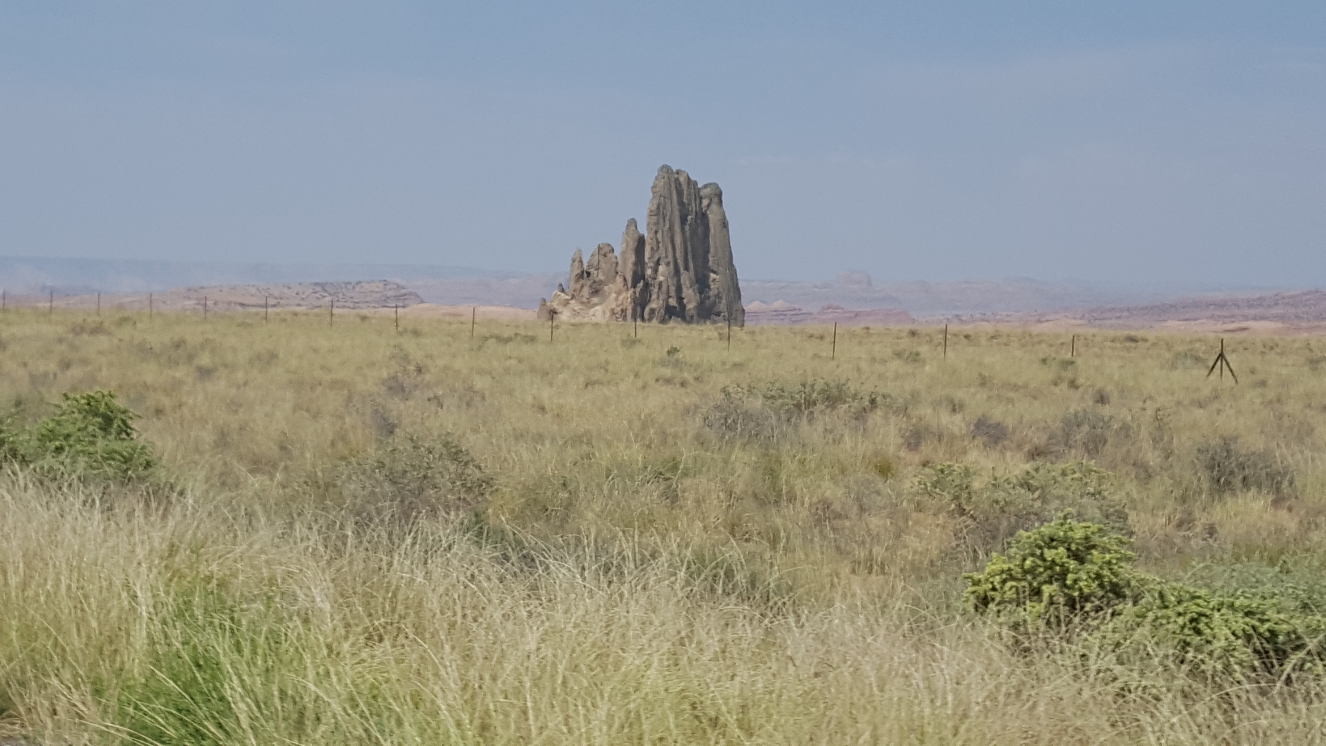
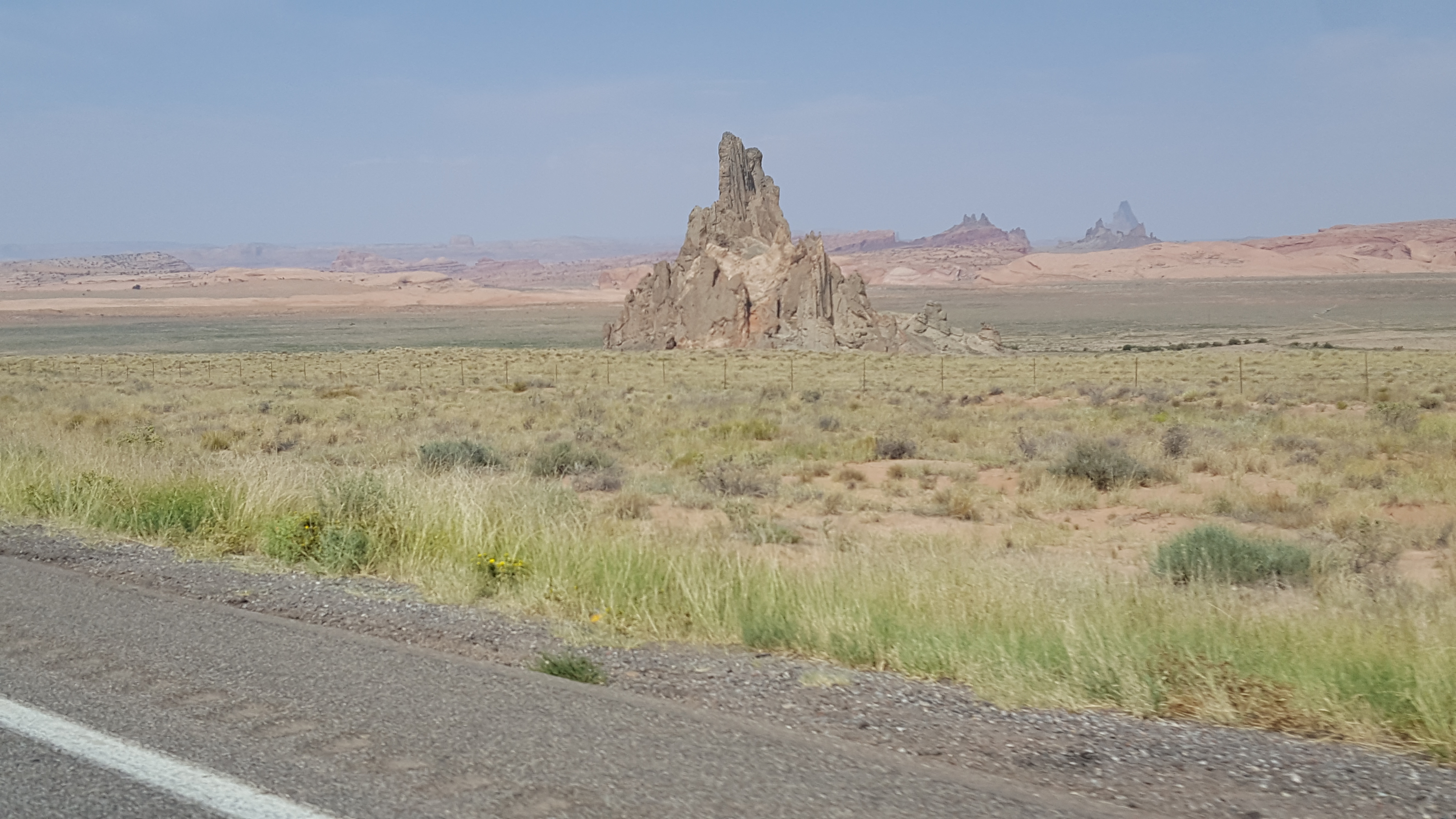
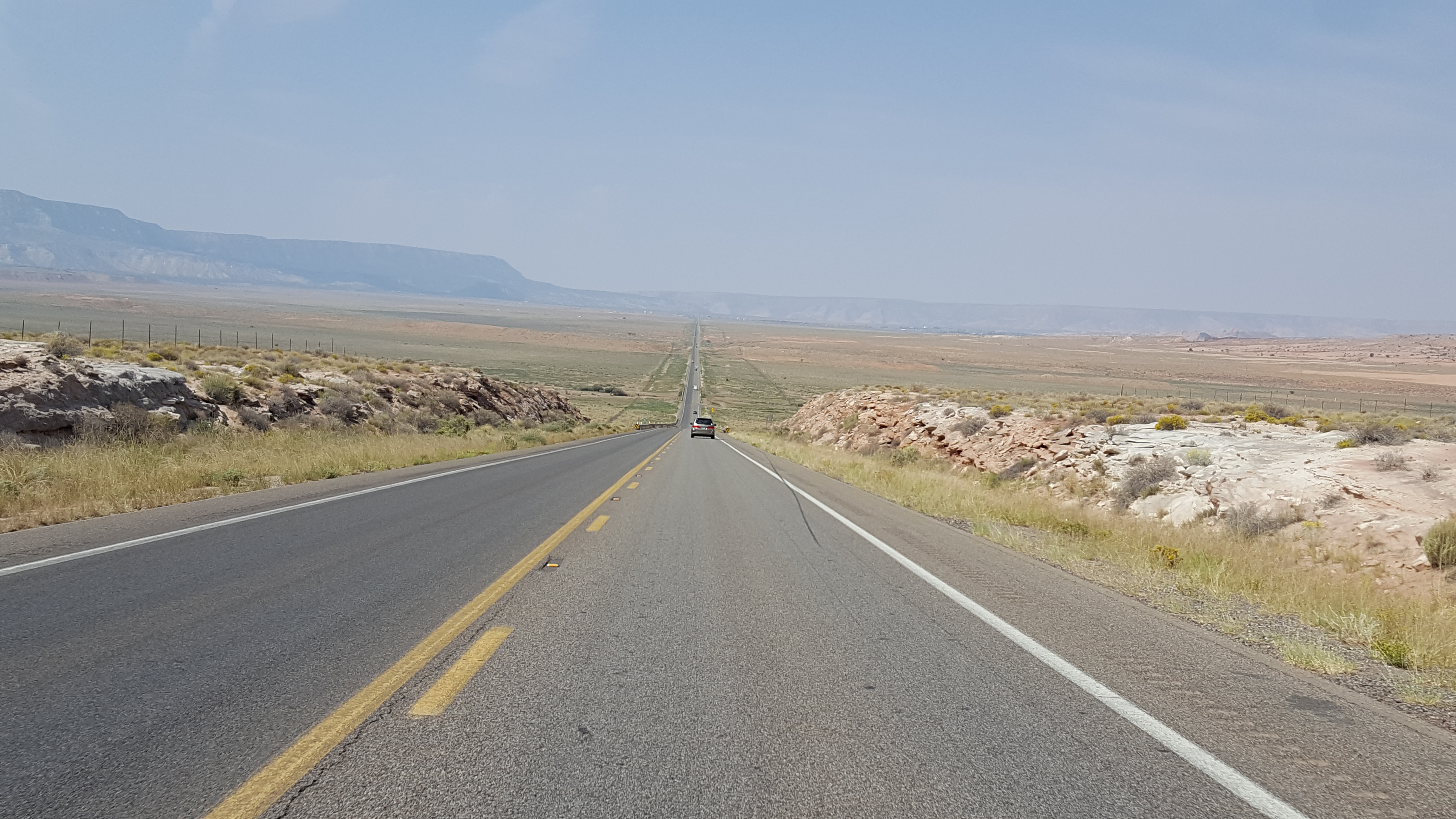
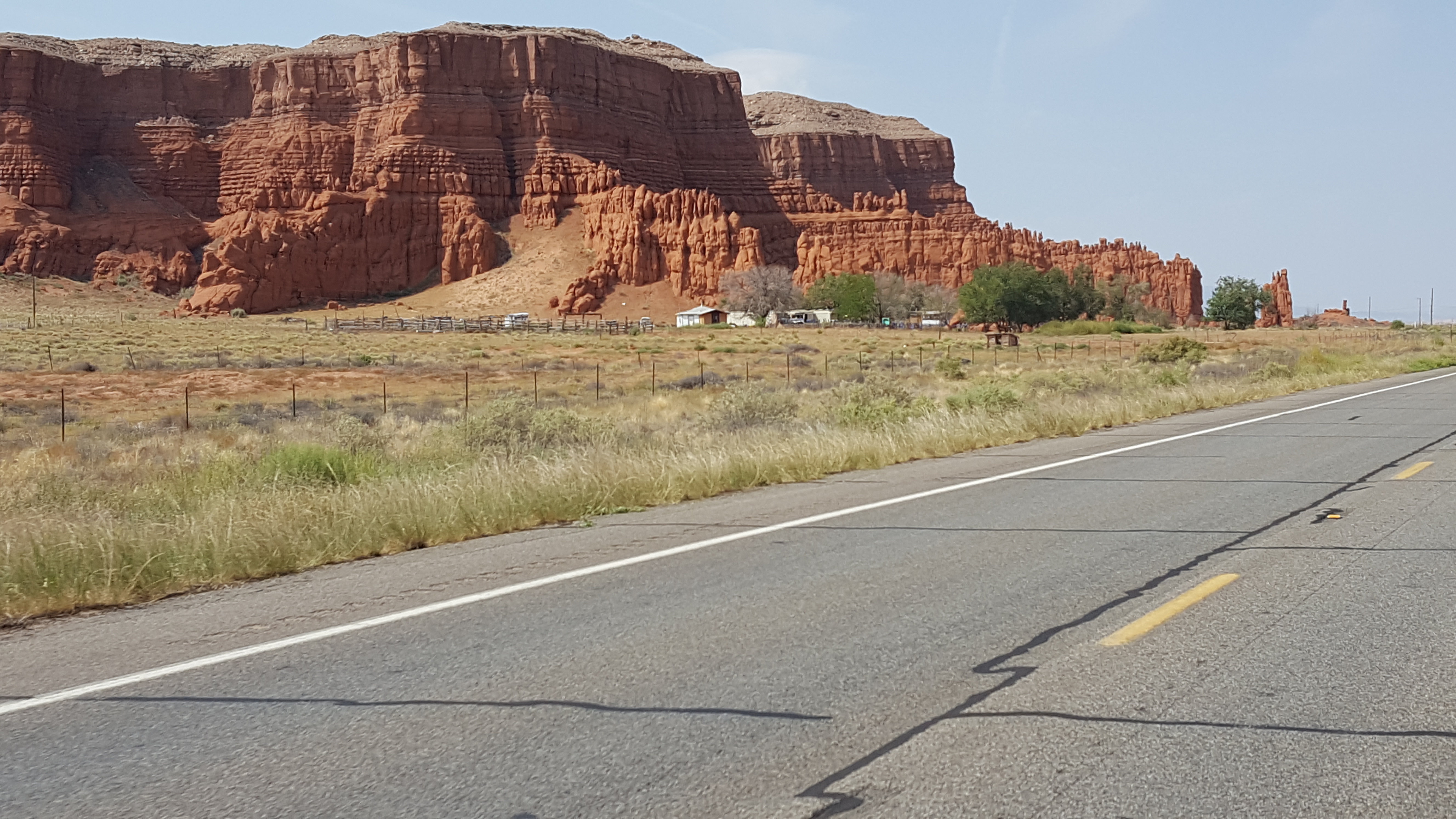
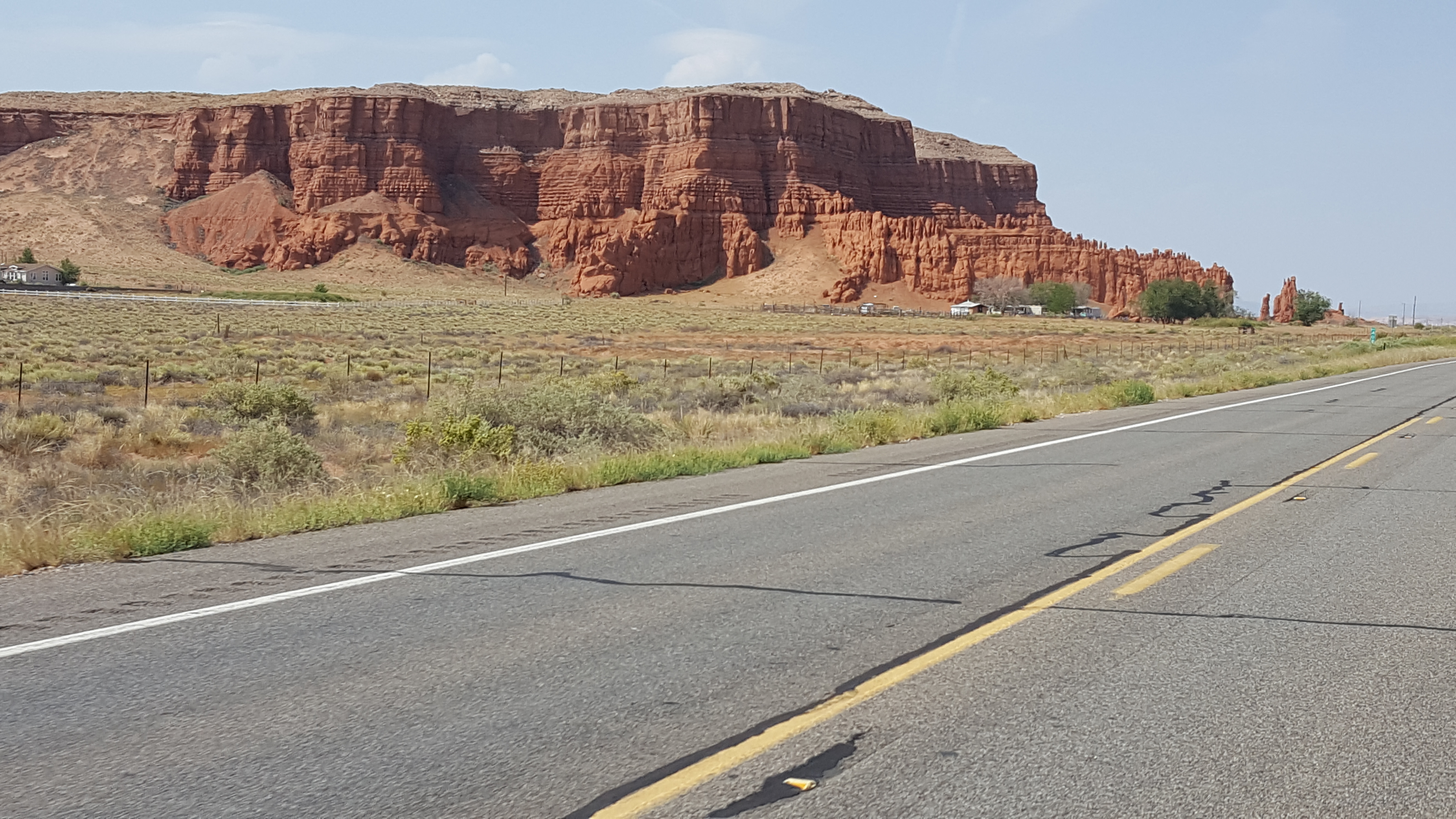
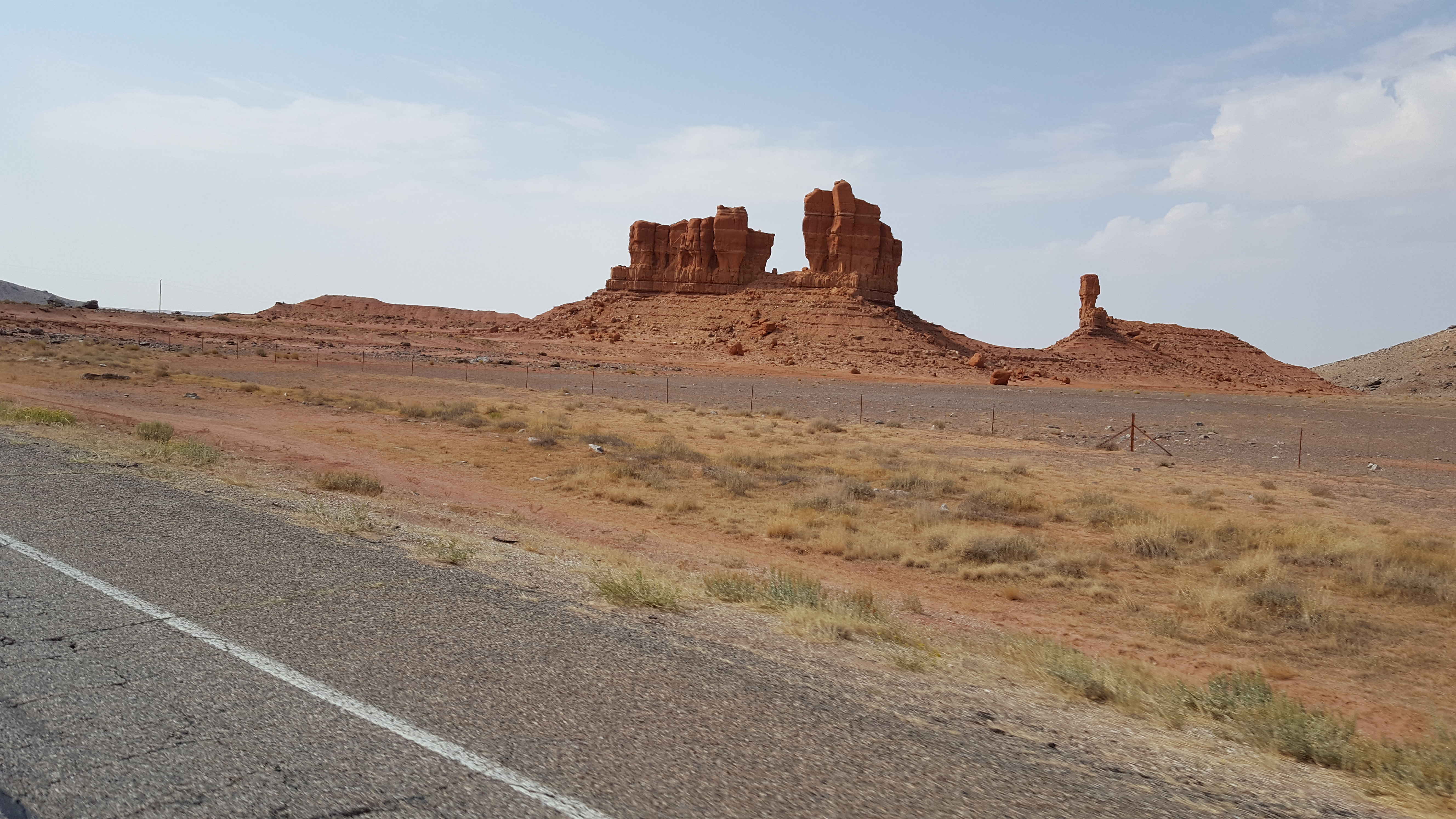
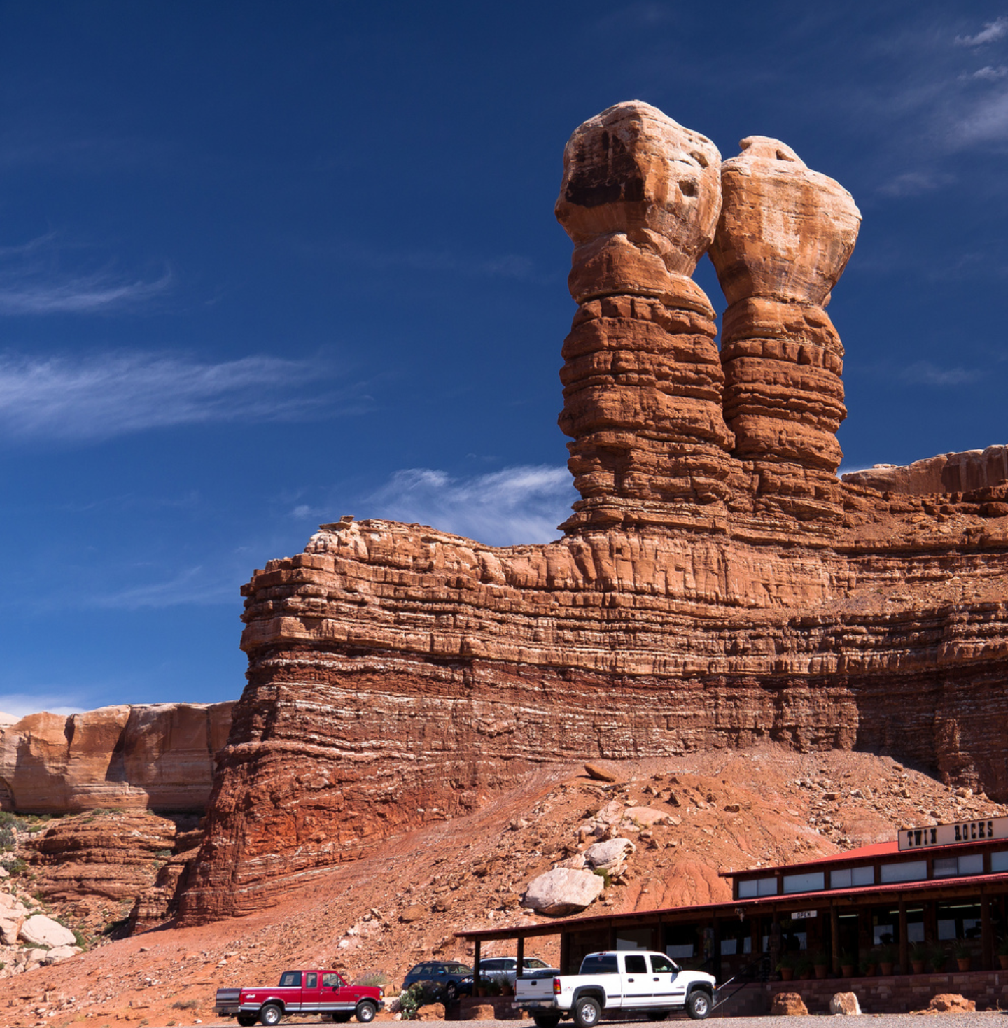
We packed up our tents, packed our bikes, and hit up the diner in Moab again. We were headed towards Antelope Canyon on routes 191 south then 160 west to 98 west. The views were amazing! We went through Bluff shortly after leaving Moab (100 miles) and on our right hand side there were two rock formations that stood out. They were two rock towers, side by side, and identical. They are known as Twin Rocks. Unfortunately, I didn’t get a picture of them as we continued our way, but I found an image online that has a great picture of them. We continued on and I just kept observing the landscape. It is truly incredible! I couldn’t stop looking at all of the red buttes and mesas. There is nothing like it back on the east coast.
About 10-15 miles before arriving at Ken’s Tours to visit Lower Antelope Canyon, we could see the sky was dark and there was rain ahead. Each time, we talk to each other through the SCALA headsets and try deciding if we should stop and put on the rain gear or if we should keep riding. We were watching the cars coming the other way and seeing if they had their wipers on. Nobody had wipers on, so we kept riding an hoping we would avoid it. Of course we had high hopes. We didn’t want to gear up because there is very poor ventilation in the one-piece rain suits. Then, WHAM! We felt rain and pulled over to quickly change. Good thing we did! It started to rain very hard, and the wind picked up too. It was so windy at one point that our bikes were leaned over while riding straight. It was pretty wild. Luckily, this only lasted until we were about a mile away from Ken’s Tours and the sun came out.
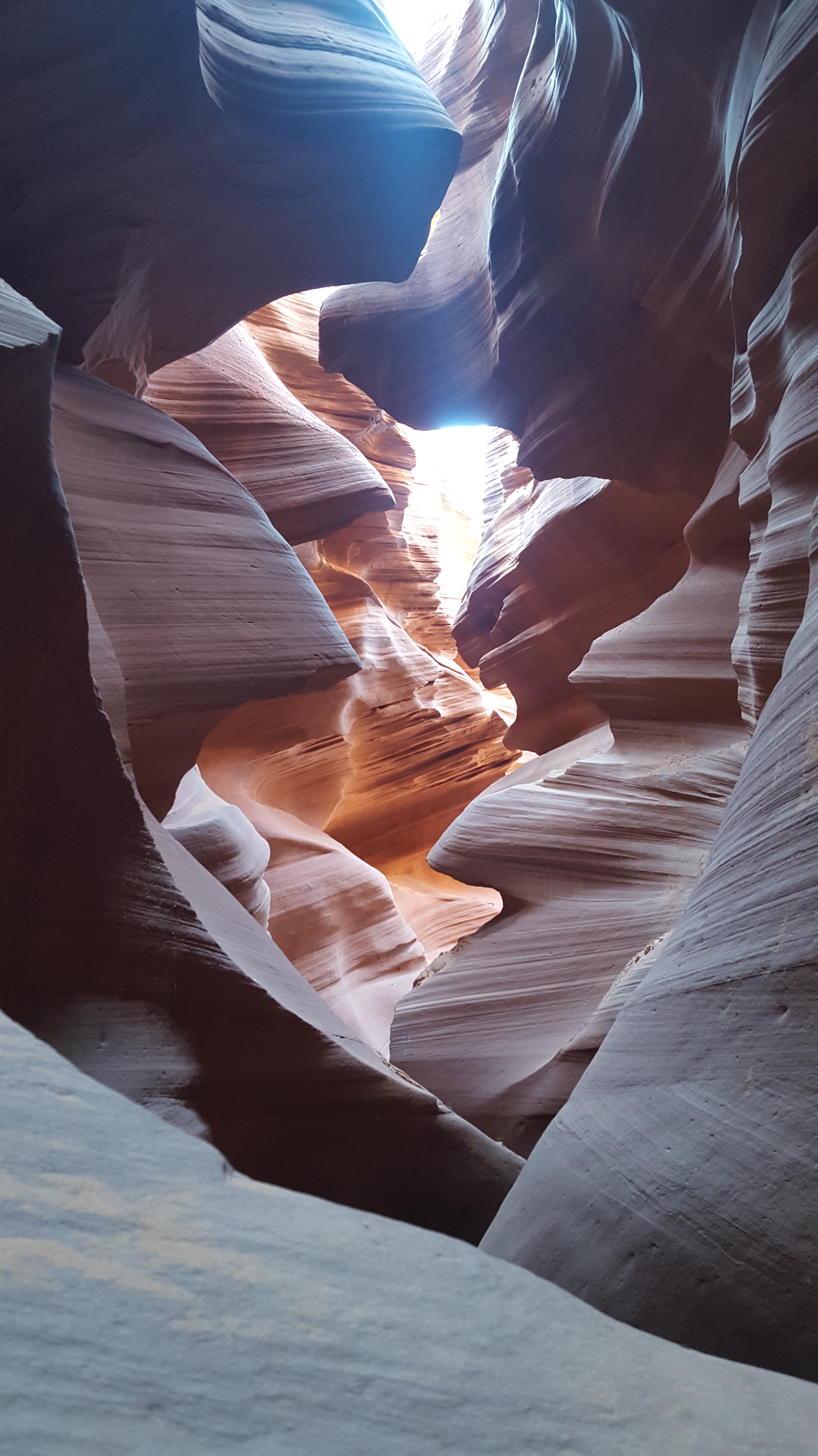
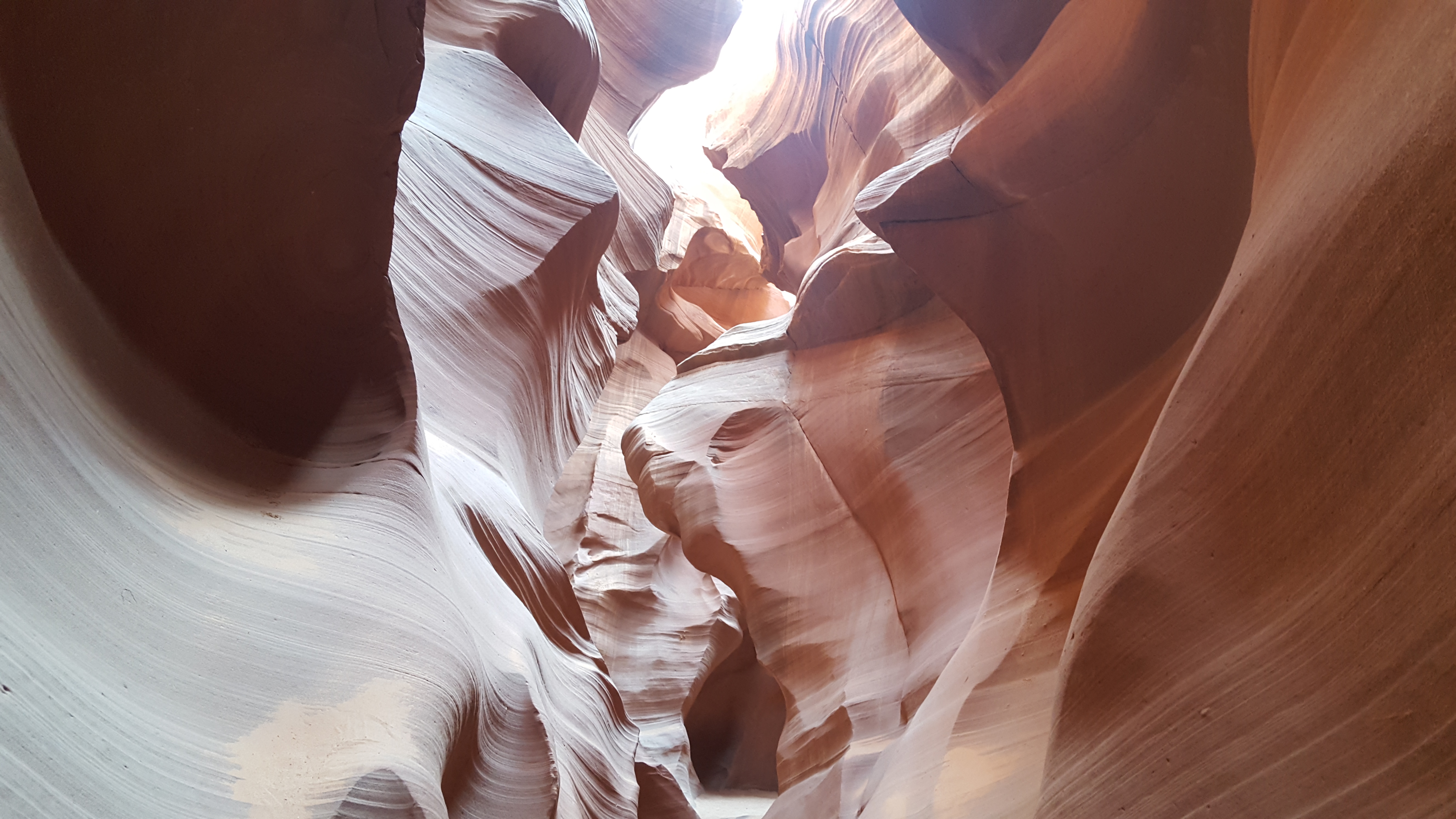
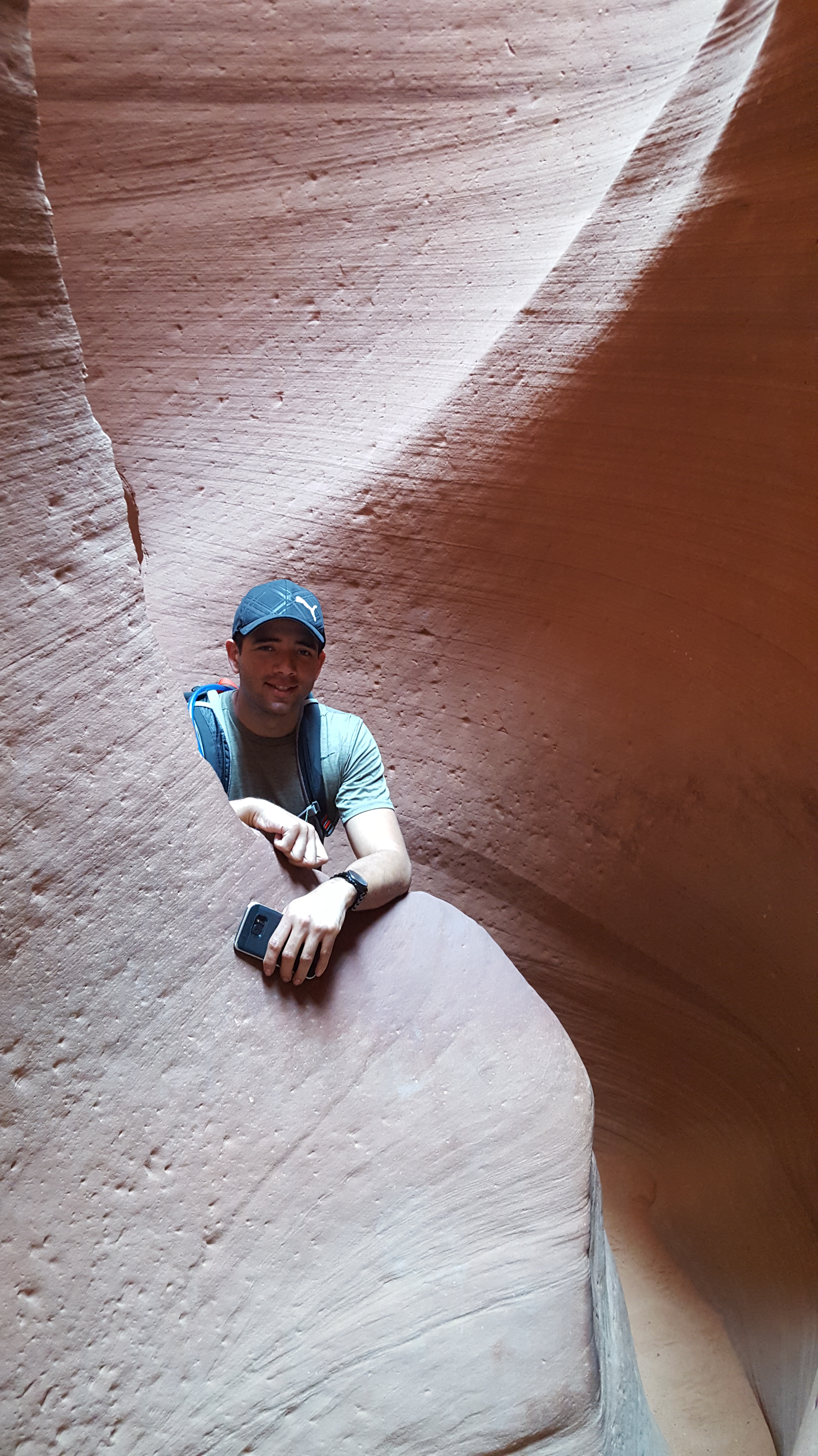
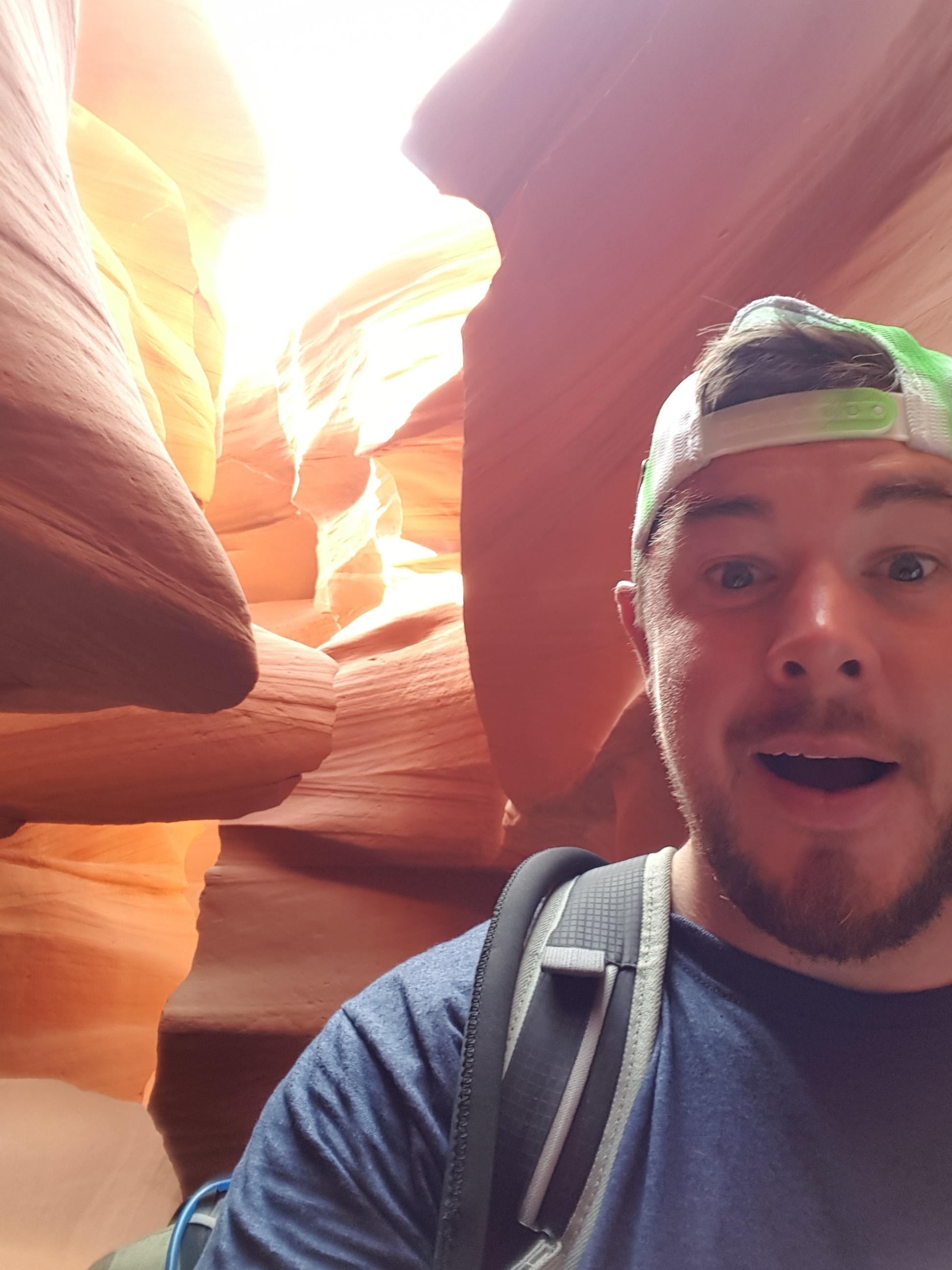
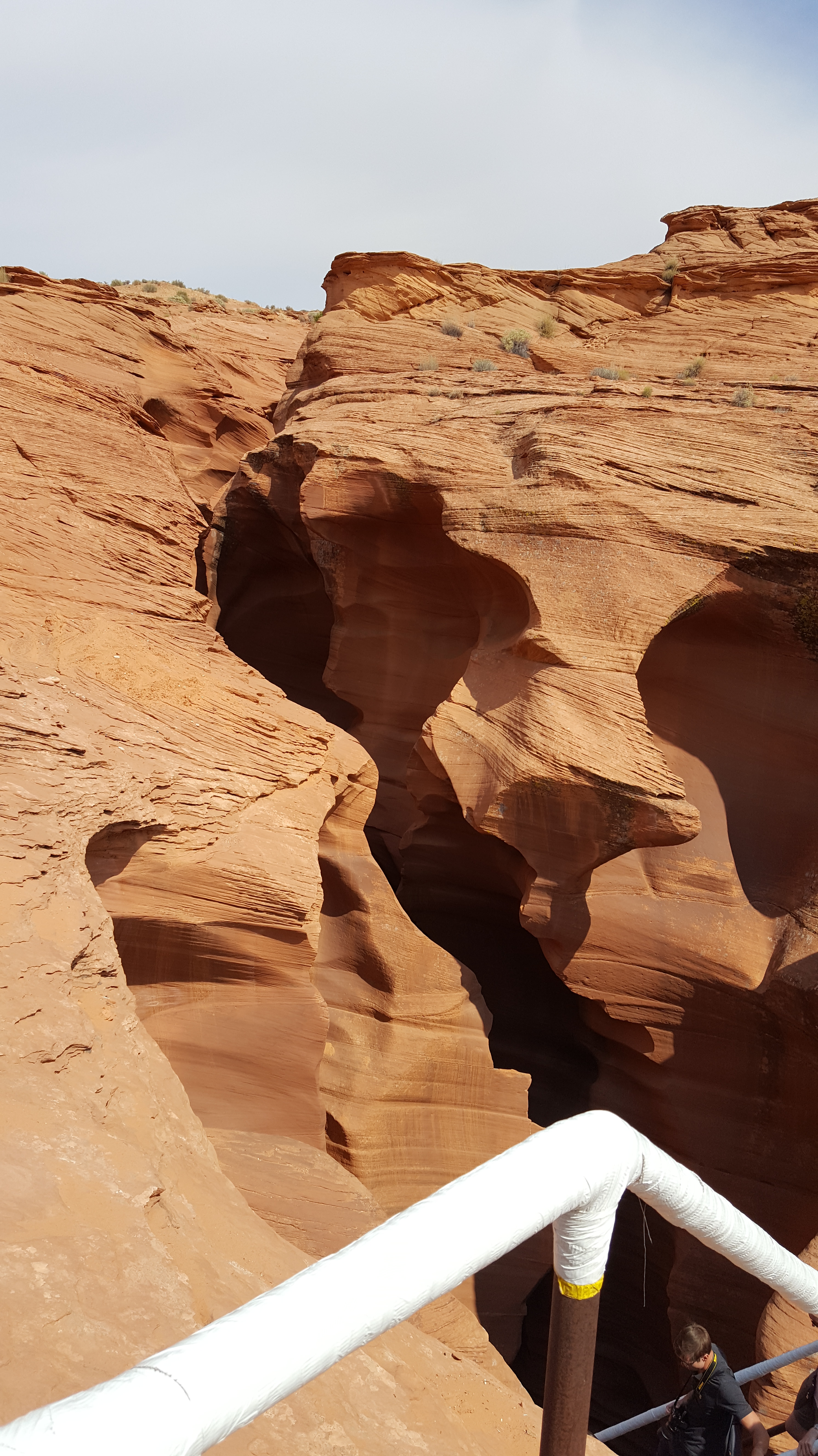
We got to Ken’s Tours, signed up (cash only) and were assigned to our tour guide, Tevin (I think). Gabe and I were talking with him. I try to talk to the locals and not be so touristy. I like to think this helps when it comes to local knowledge and ideas of what to do. In this case, Tevin changed my camera setting to make the red rock colors pop. He also showed Gabe and I some cool things in the canyon rather than just let us walk by.
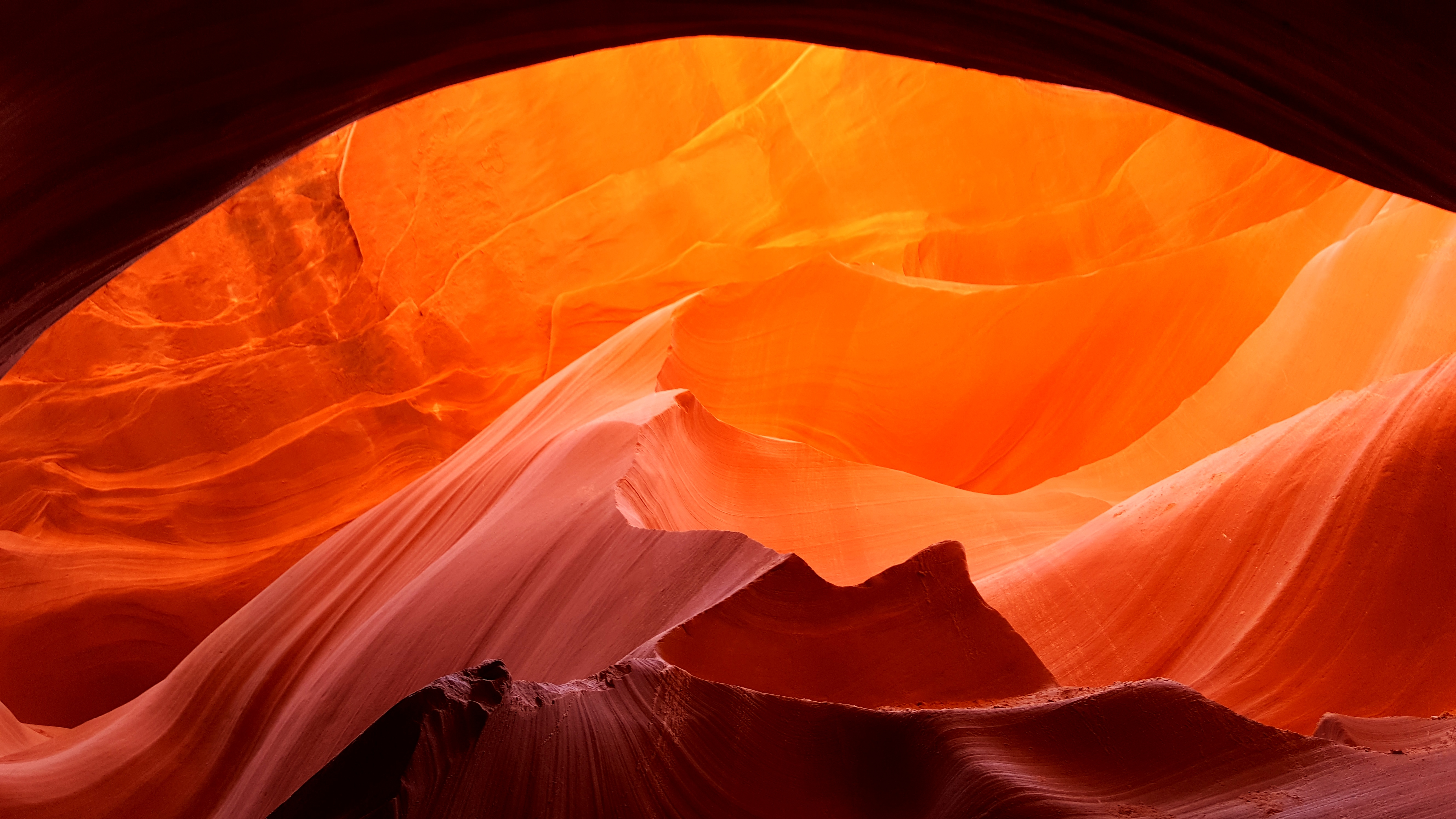
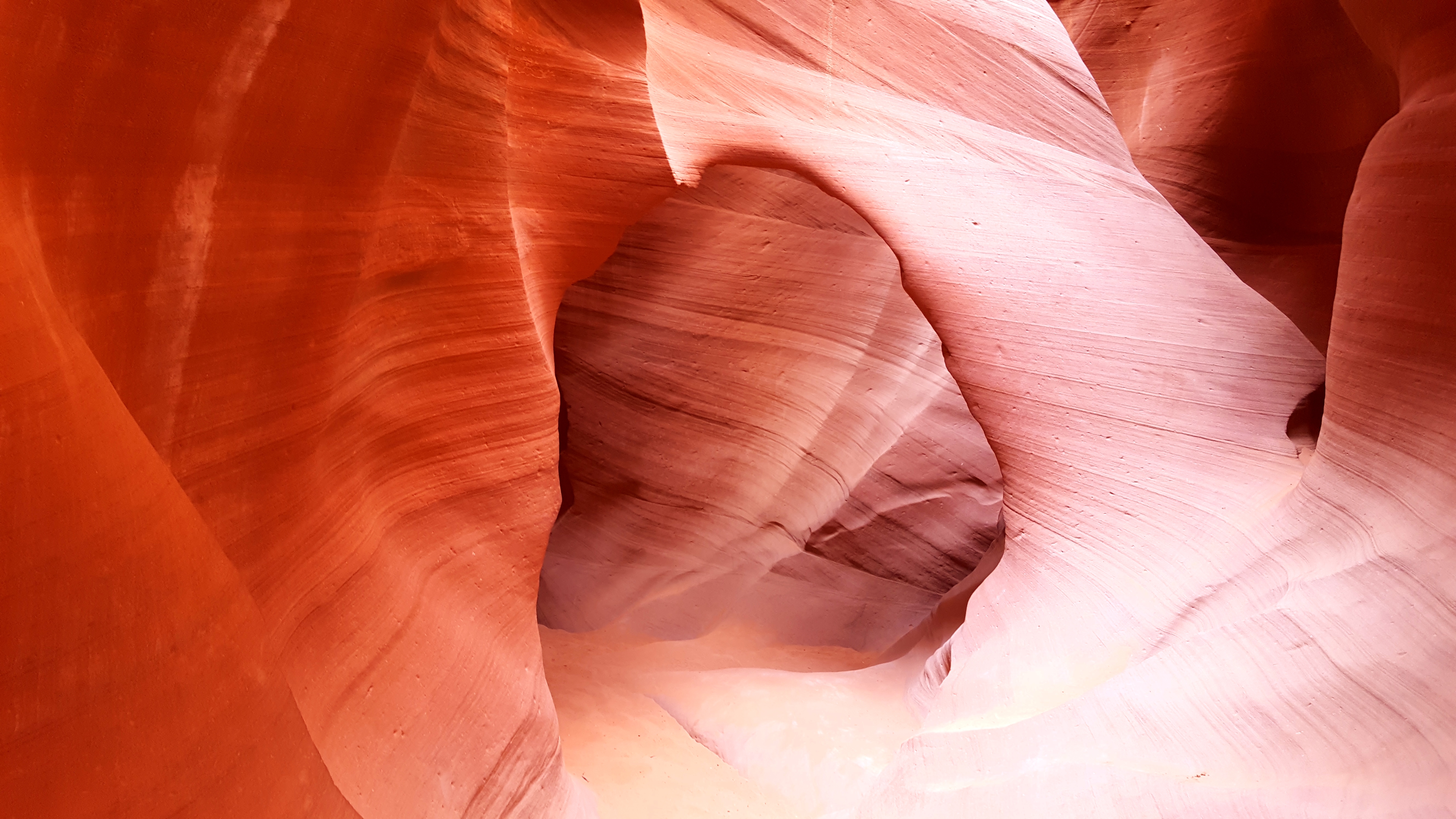
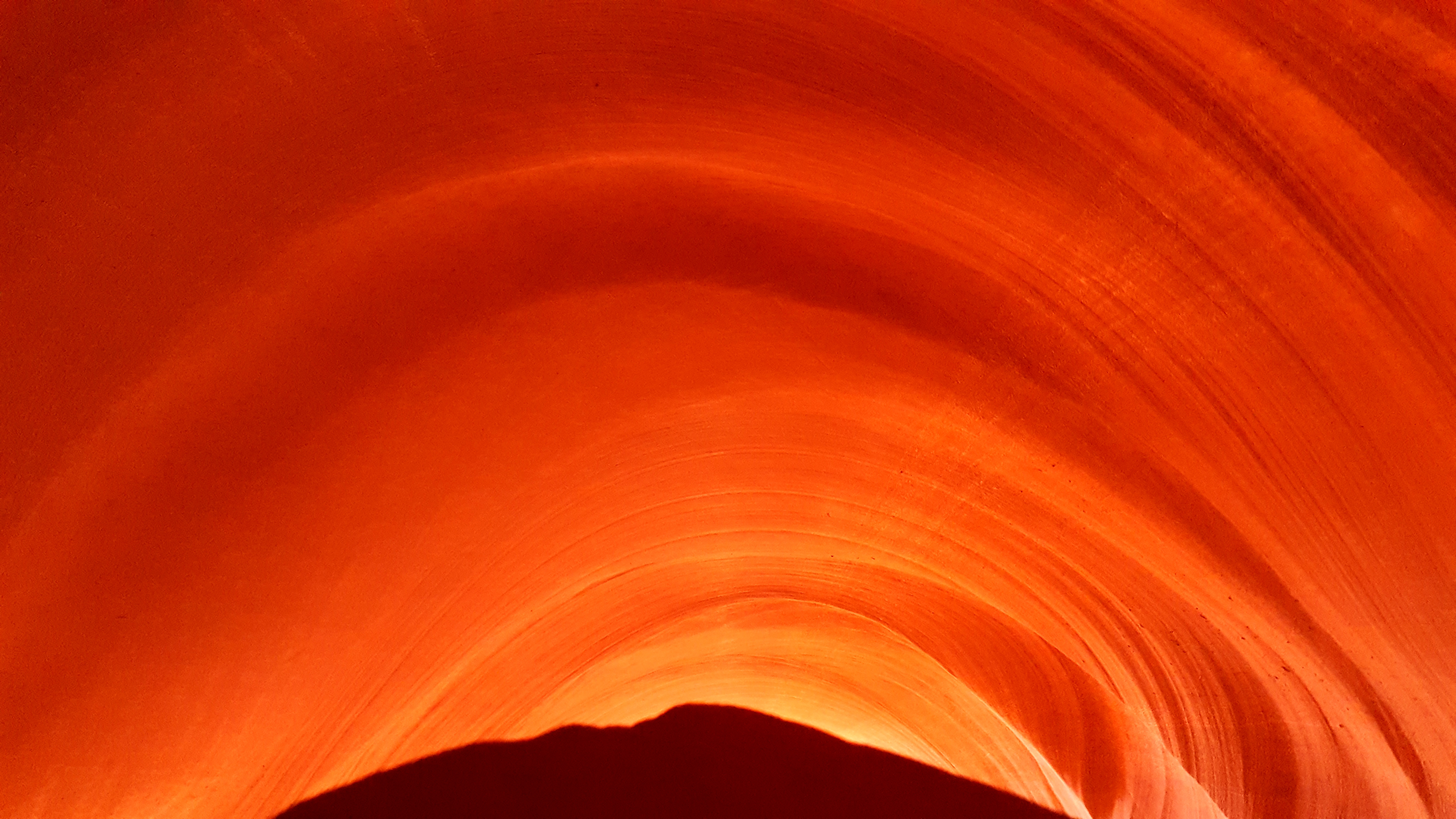
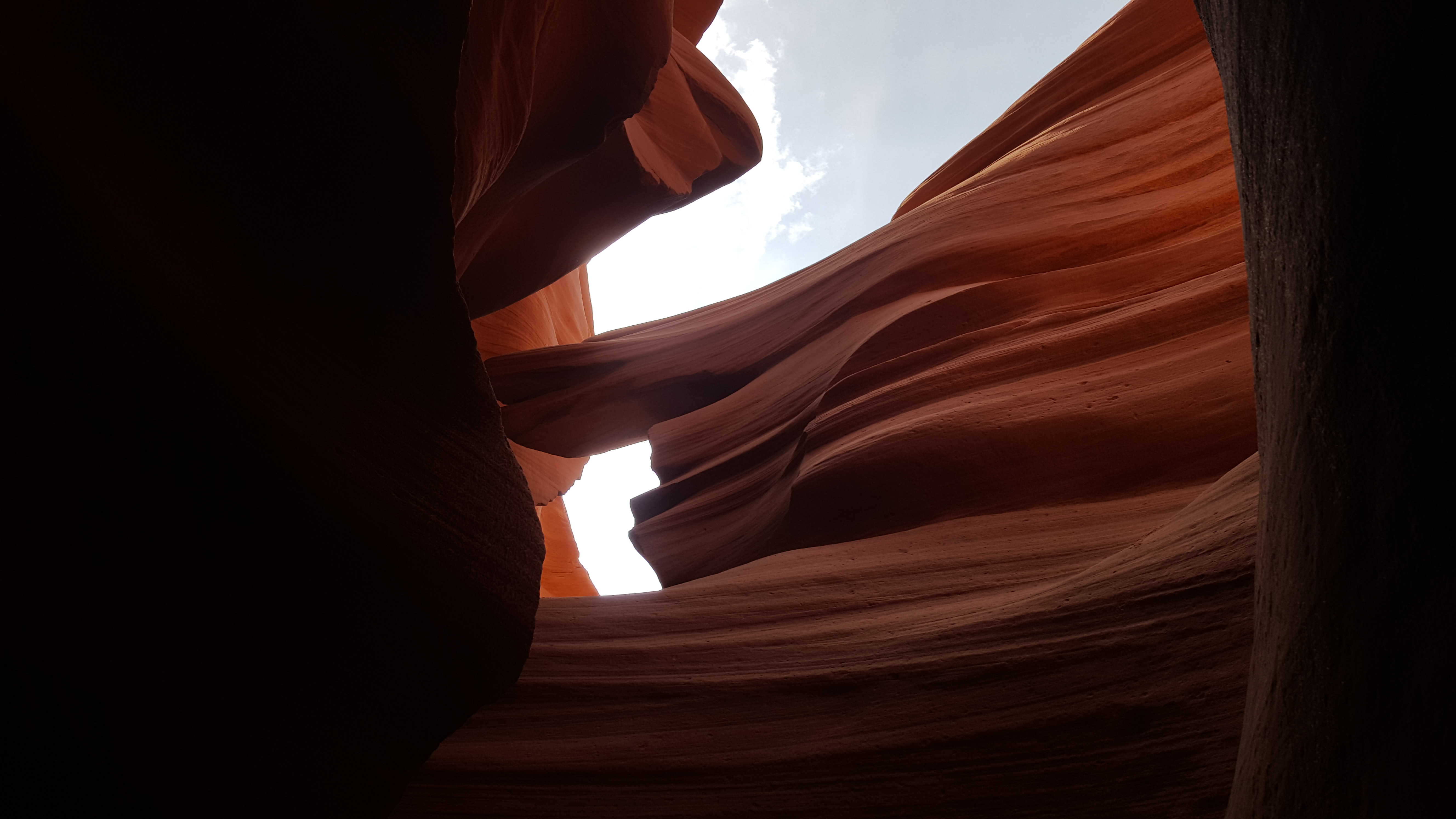
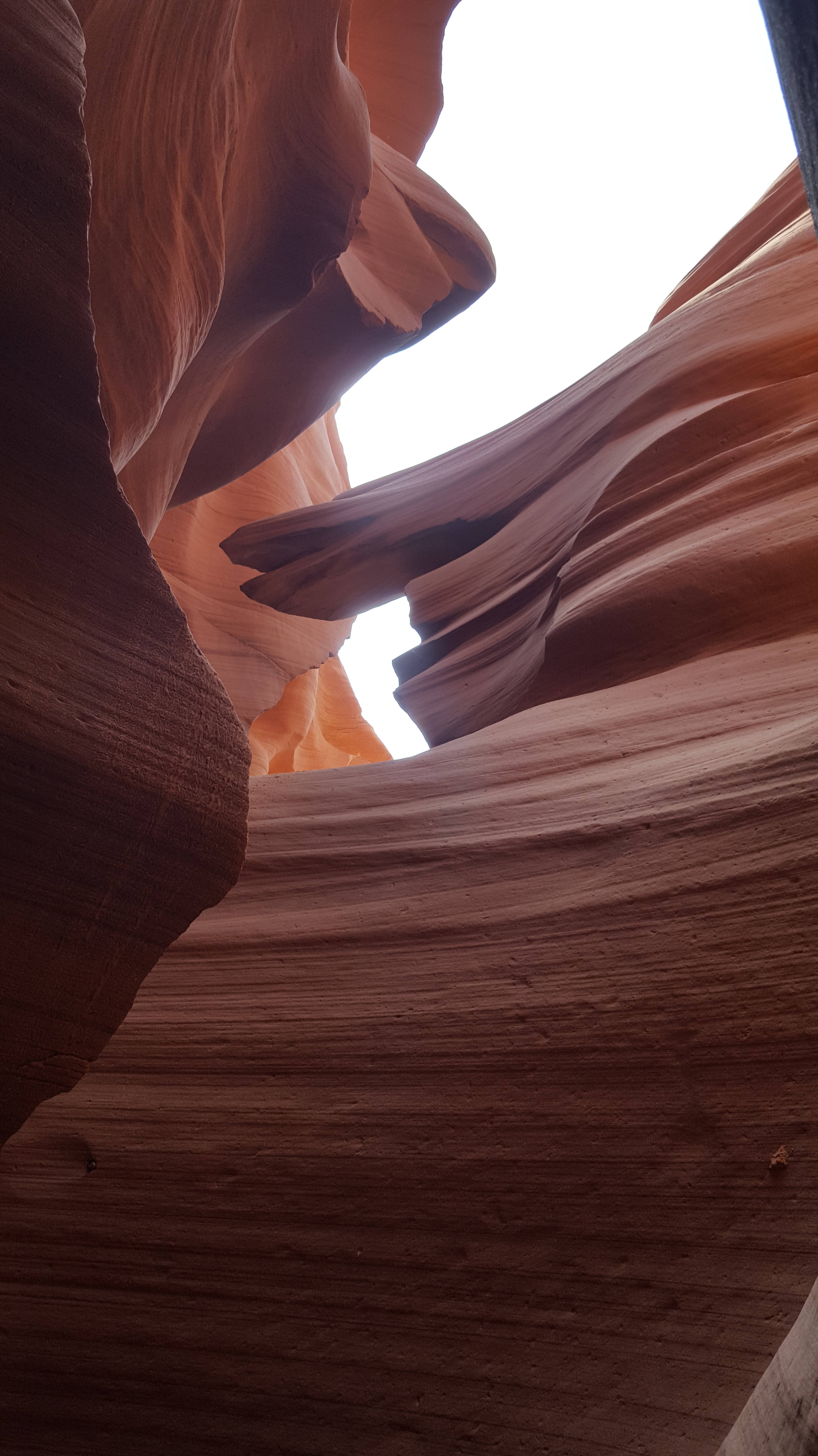
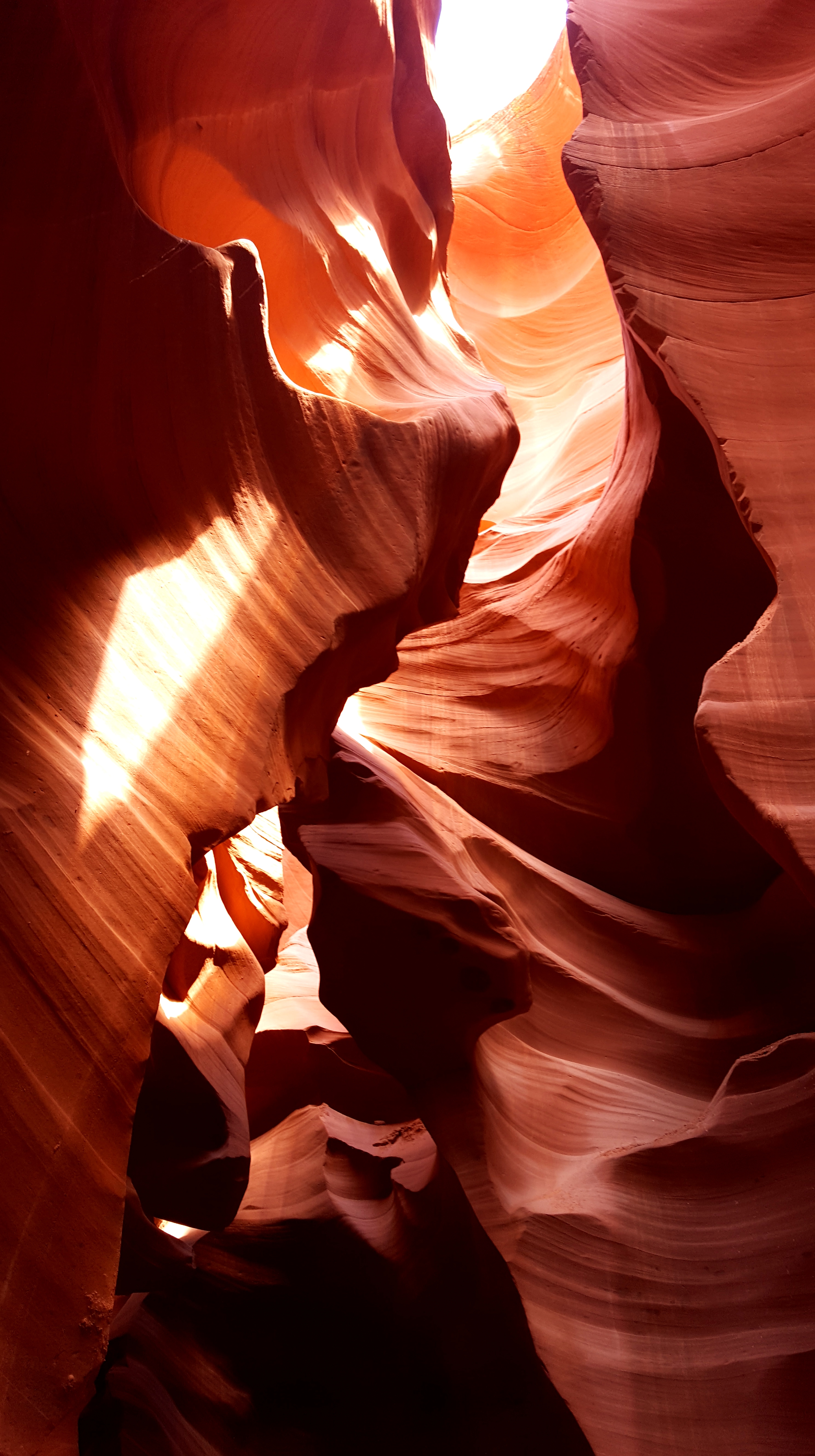
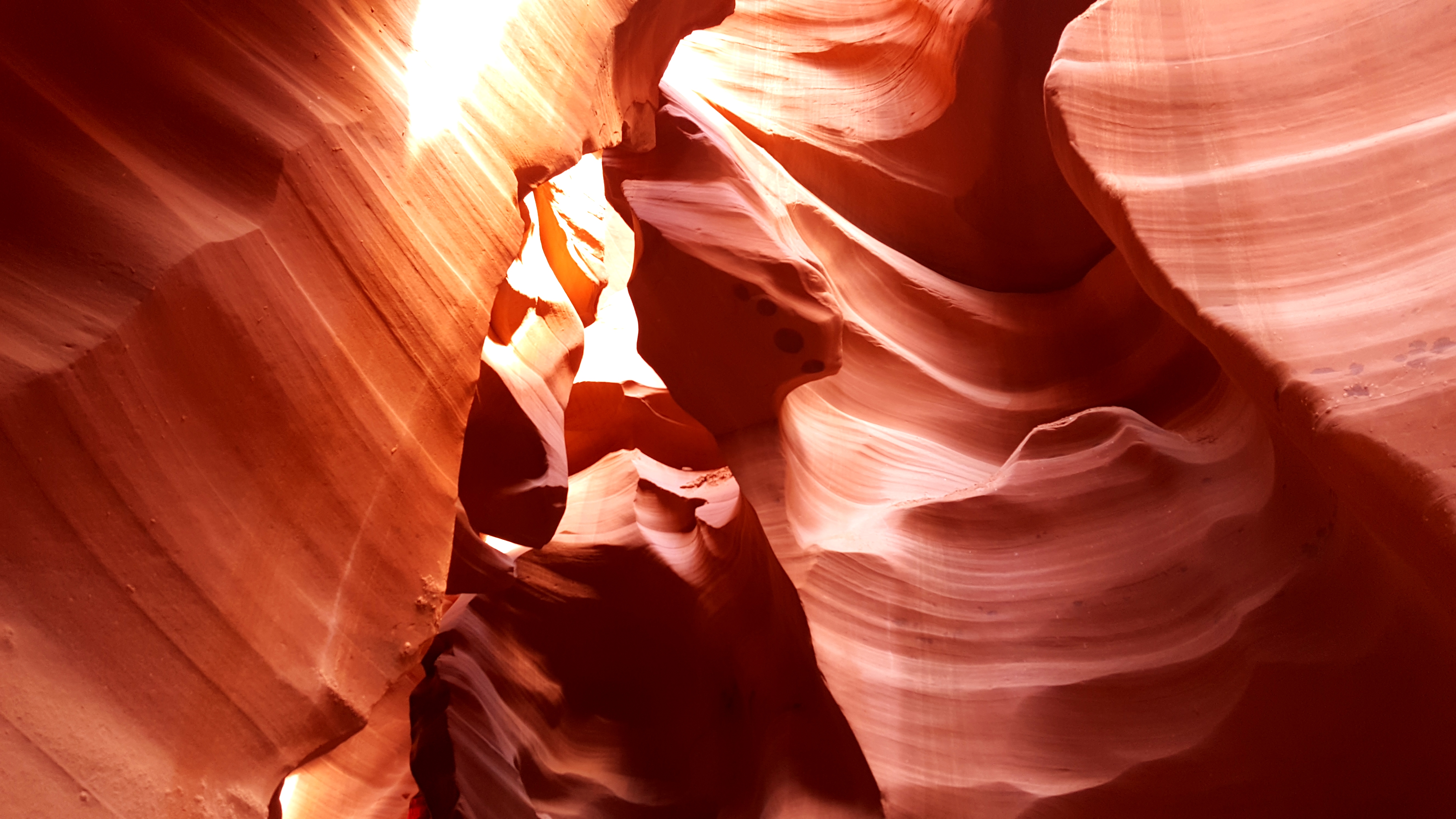
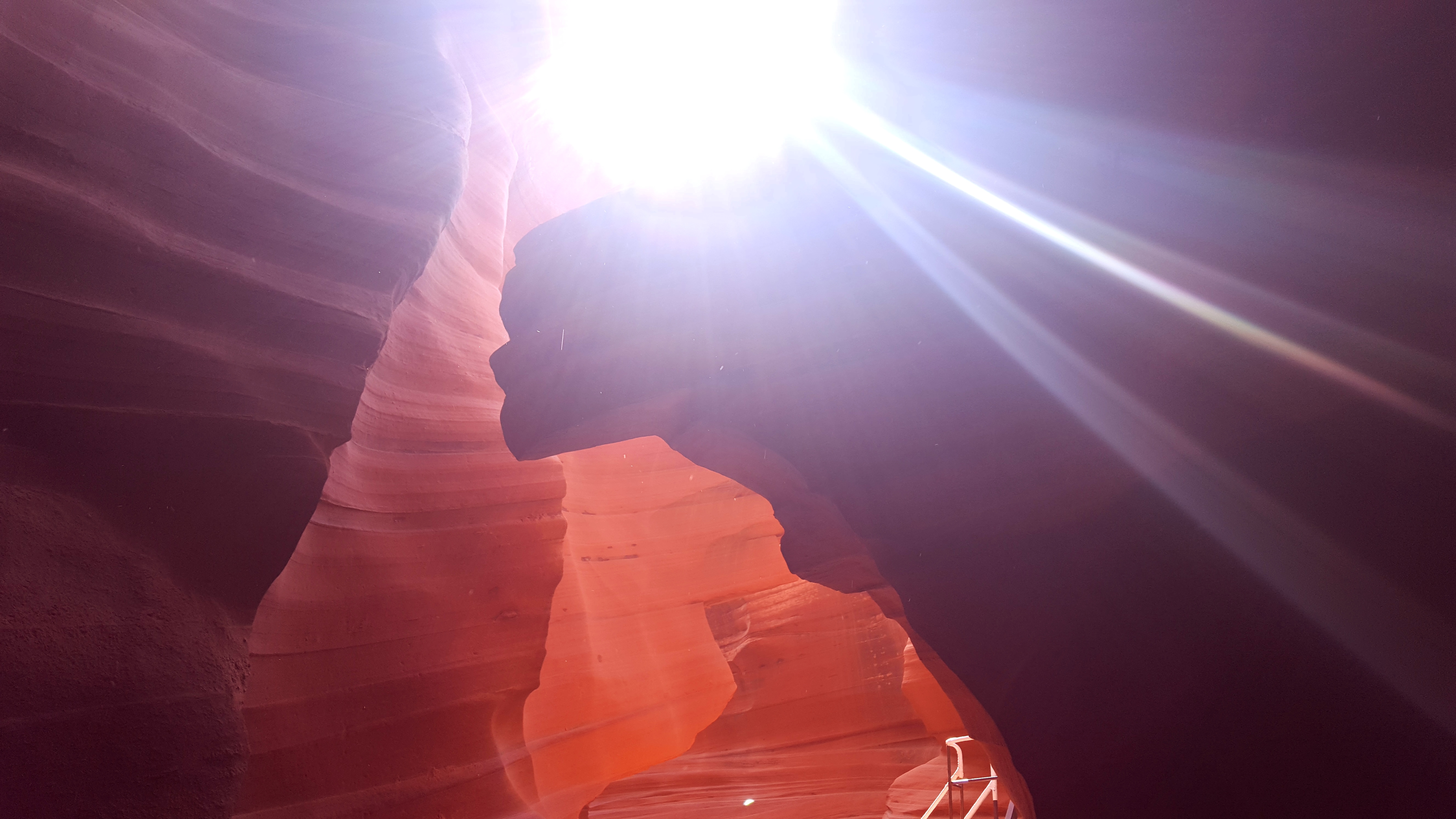
Regardless, the canyon is absolutely amazing! It really is unique how water and wind erosion can cause some incredible rock formation. I took so many pictures because every turn was just beautiful. The pictures came out awesome too.
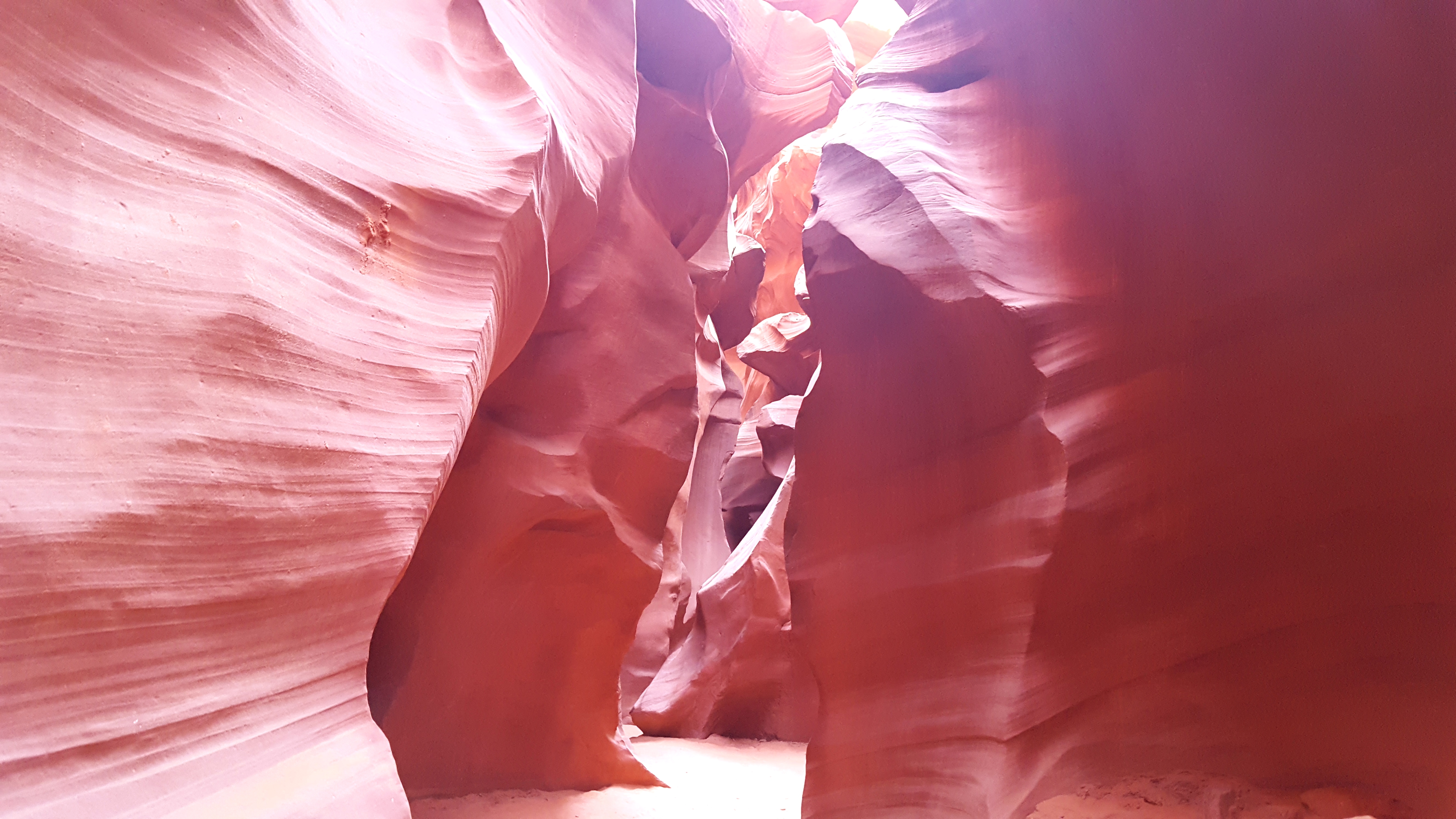
We did Lower Antelope Canyon because it is cheaper, more easily accessible (no shuttle), and less touristy. Upper Antelope Canyon is close to $100. This is more known for photographers because at the right time of day, and I think even during the right time of year, there are light beams. The main formation difference between the two canyons is the shape. Lower Antelope Canyon is wide at the top and narrows towards the bottom while Upper Antelope Canyon is the opposite. You need a shuttle to get to Upper Antelope Canyon. Whether it is Upper or Lower Antelope Canyon, you will need a tour guide because you are on private Navajo land.
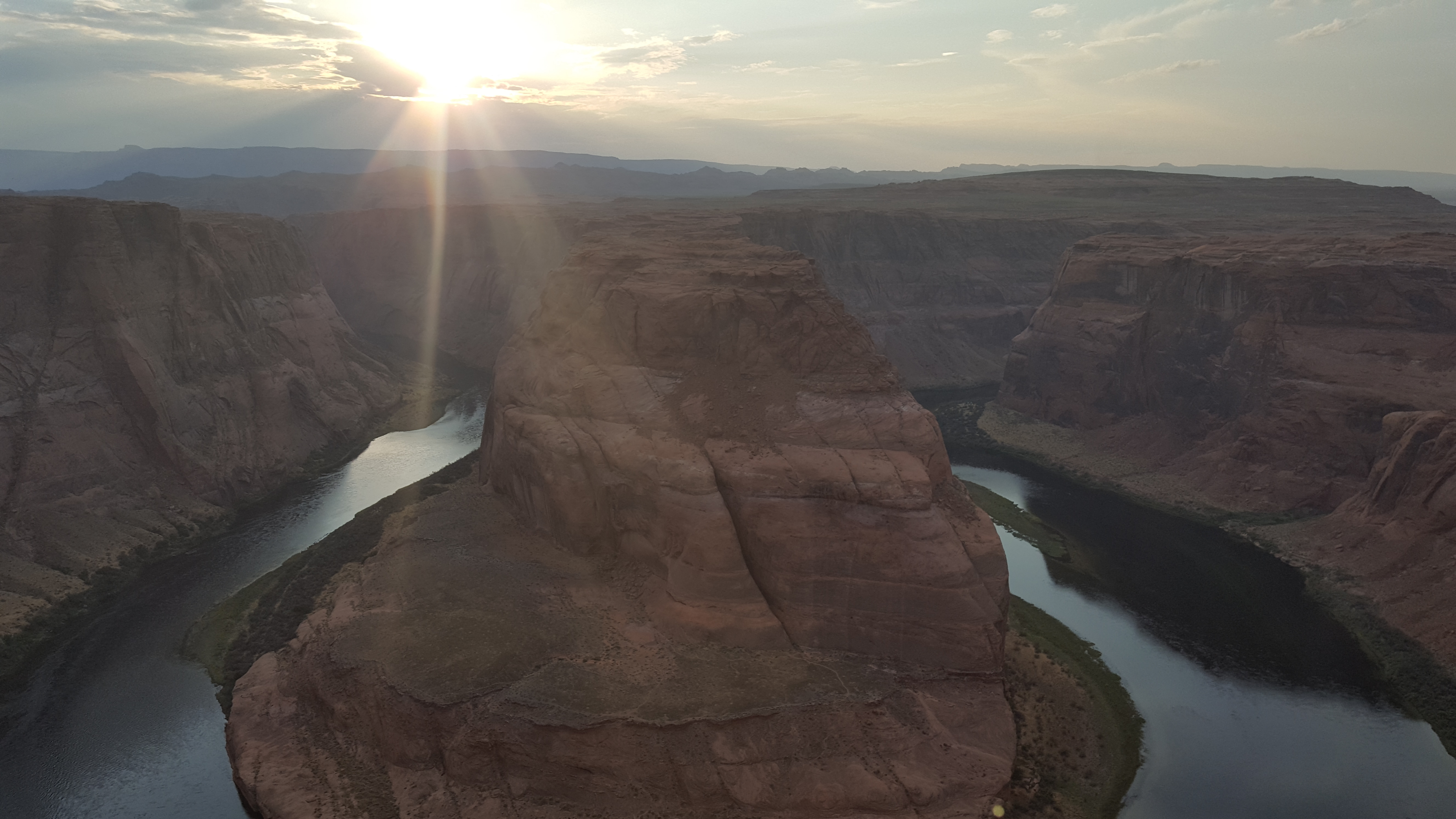
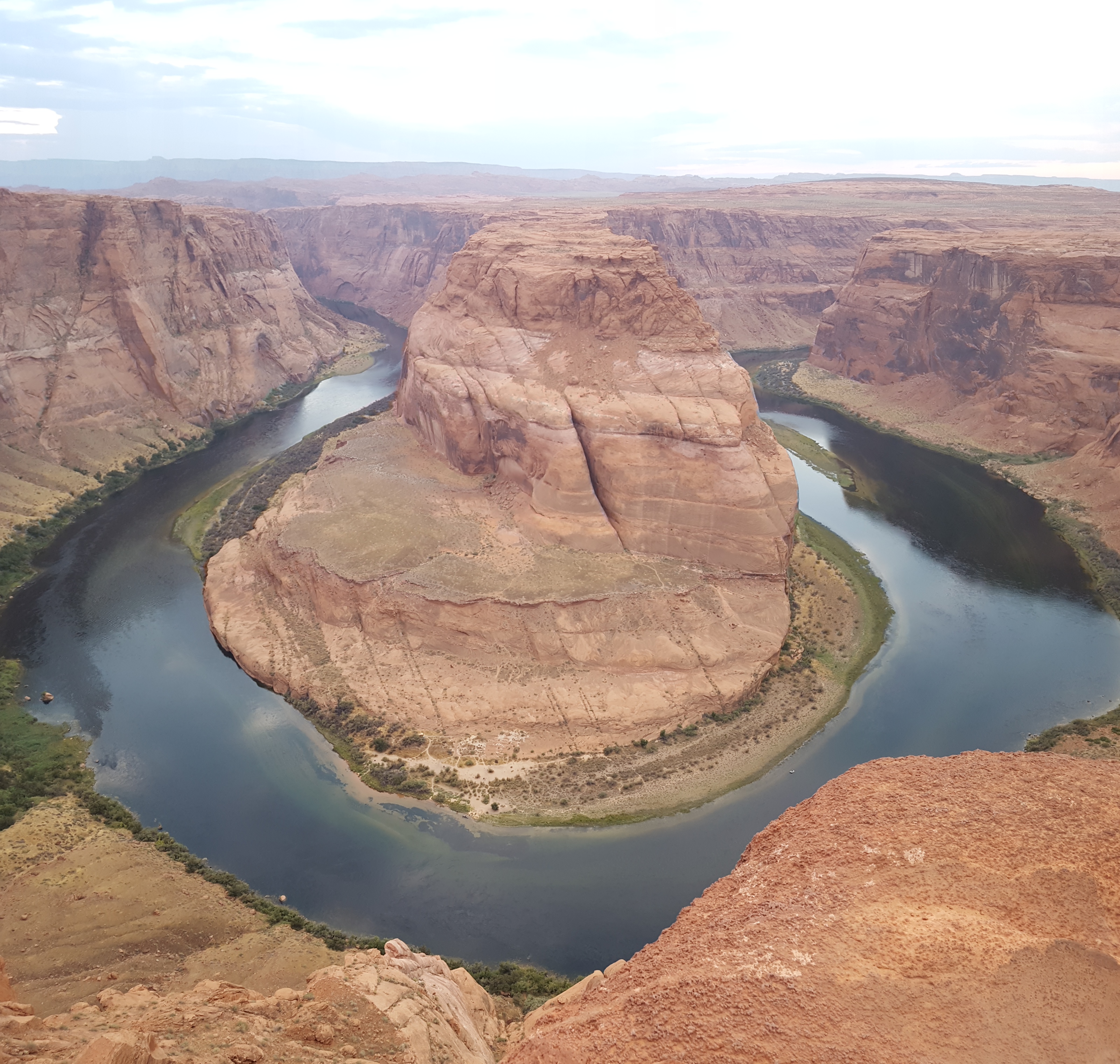
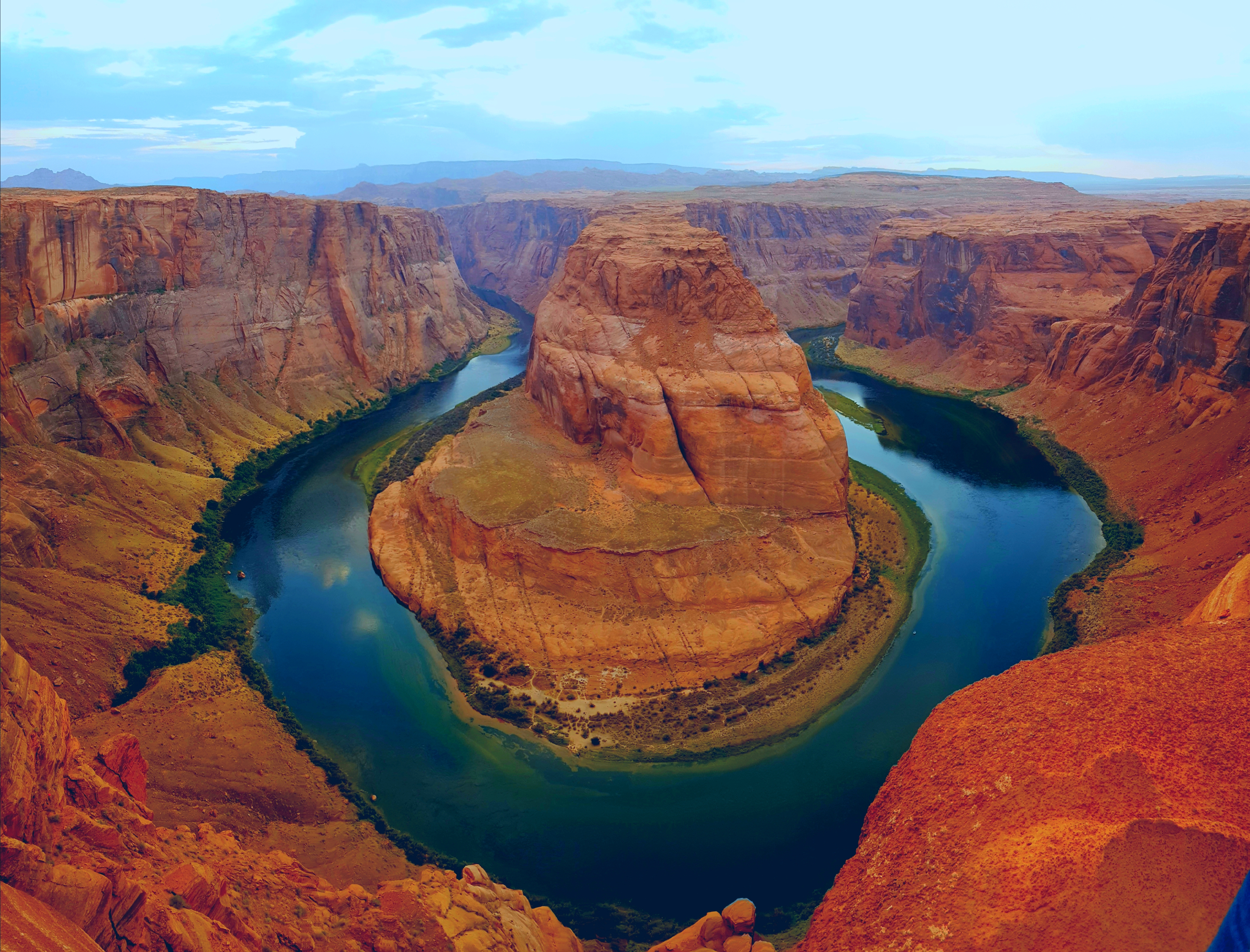
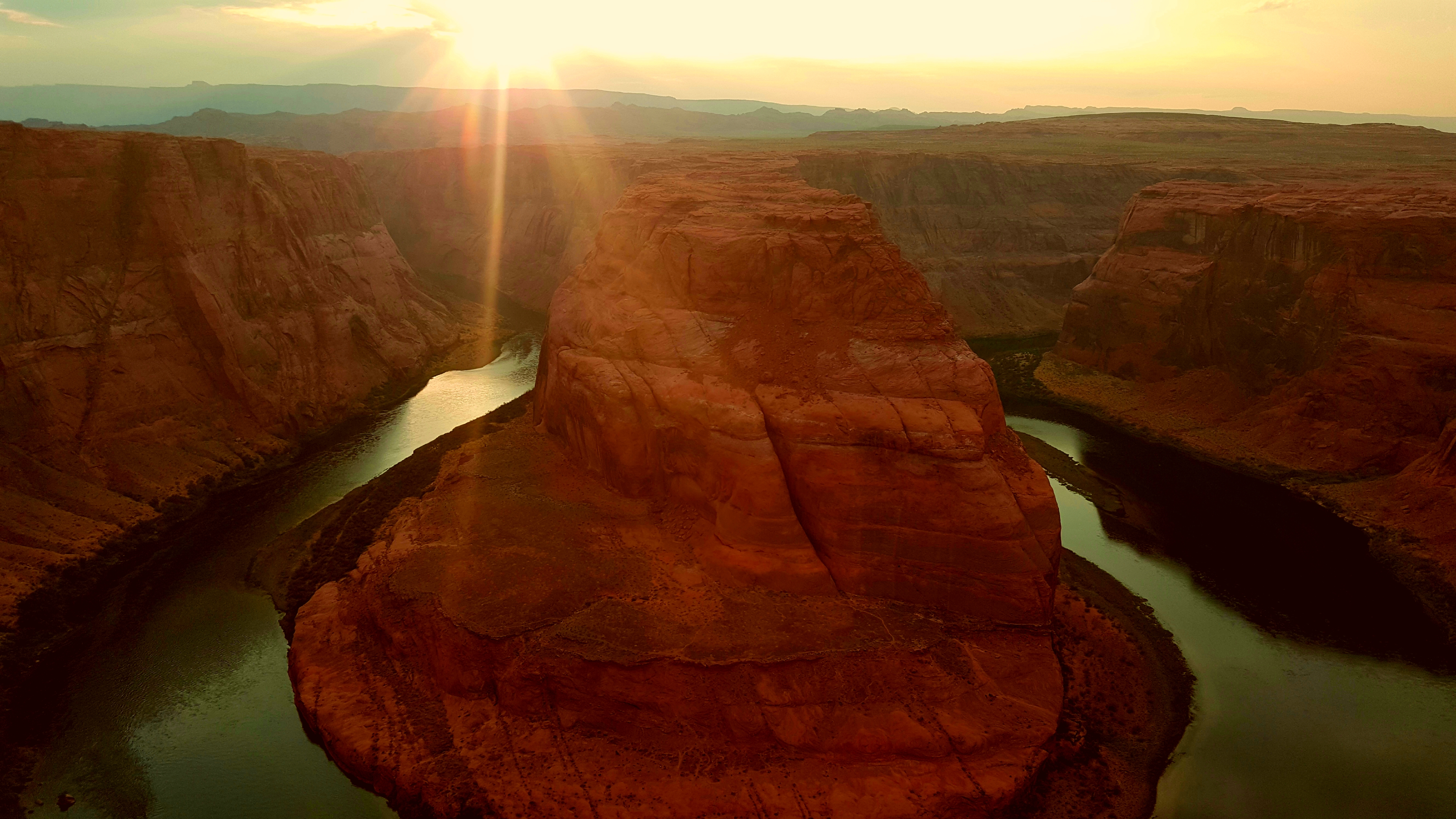
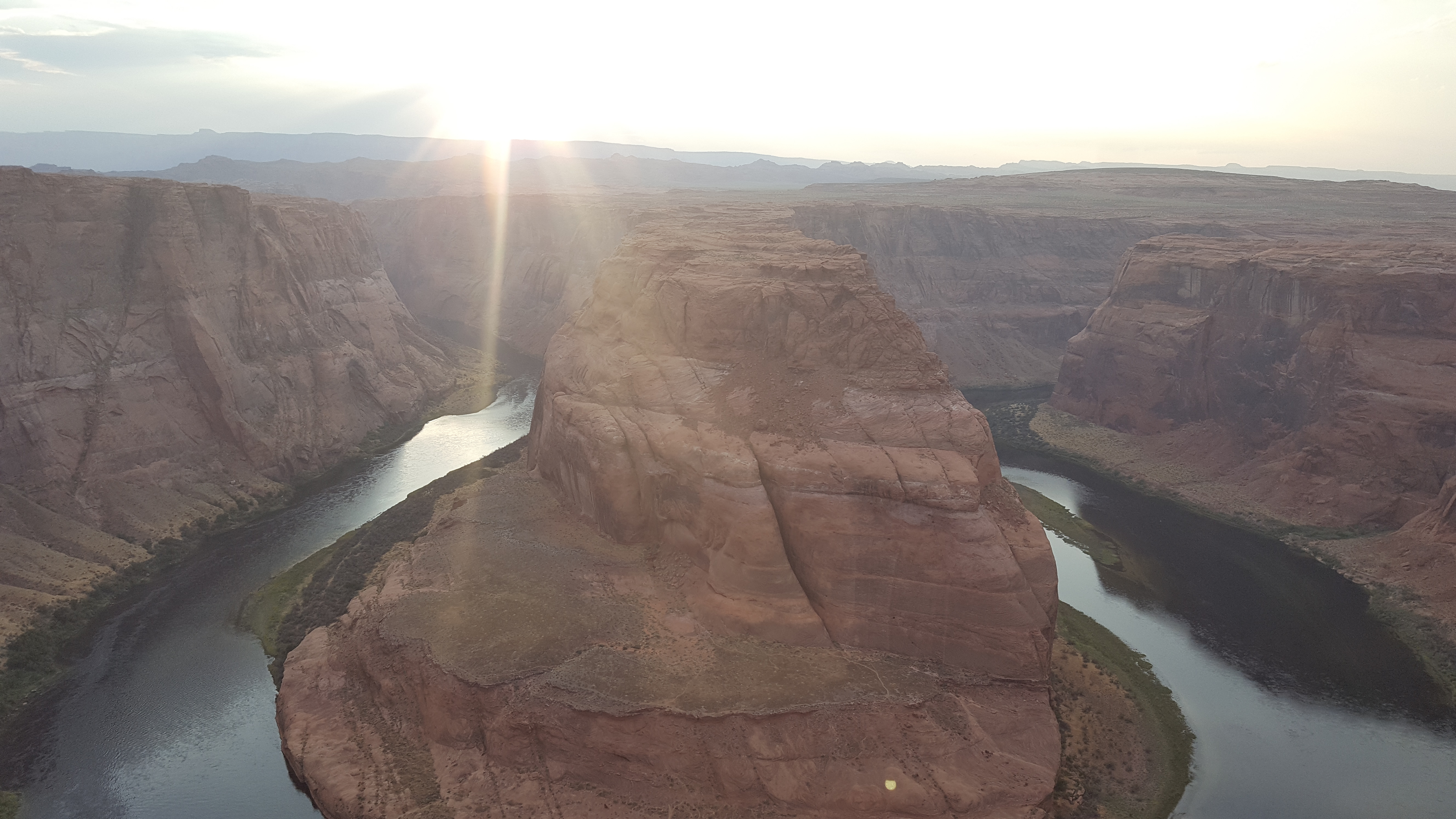
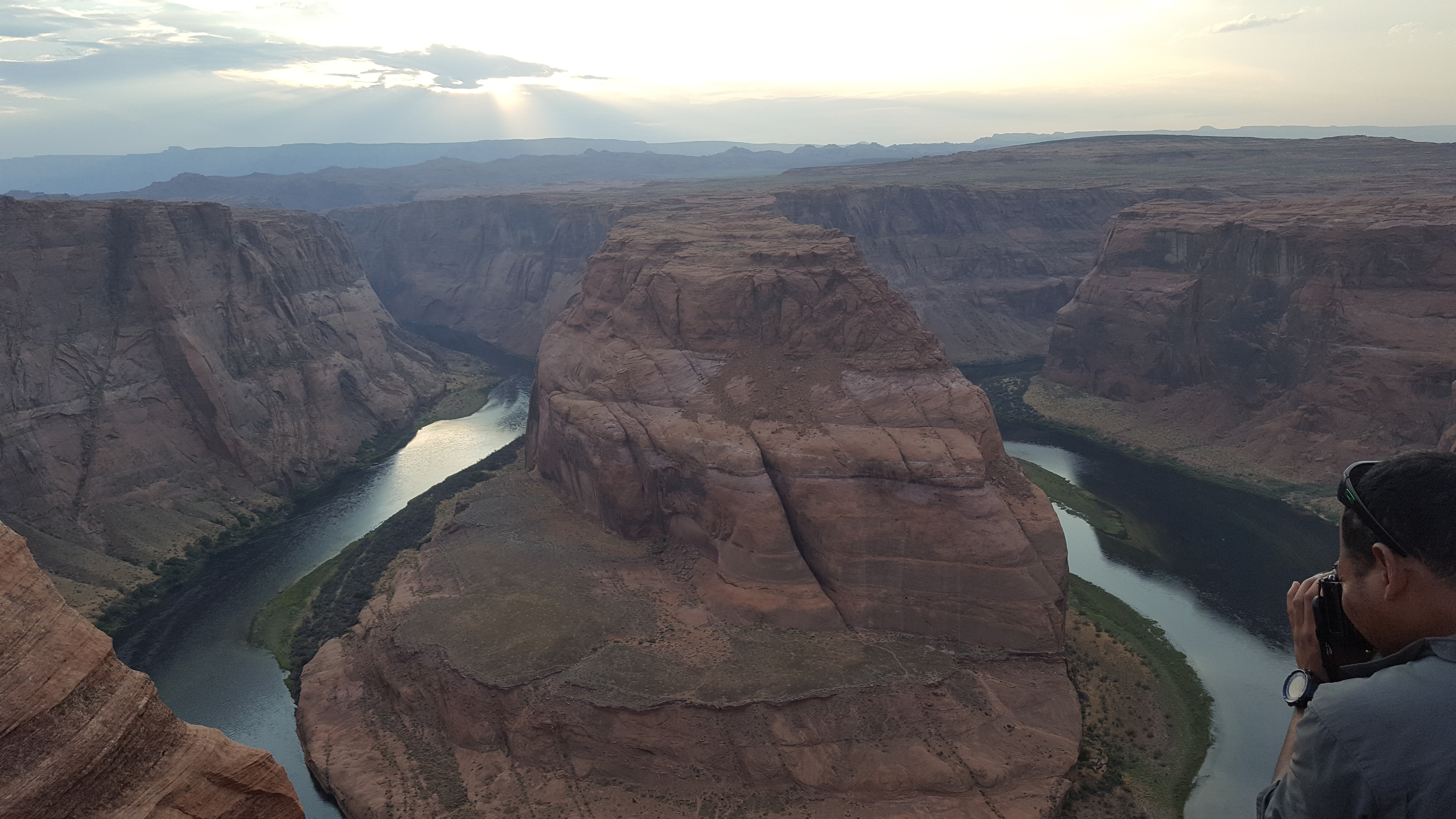
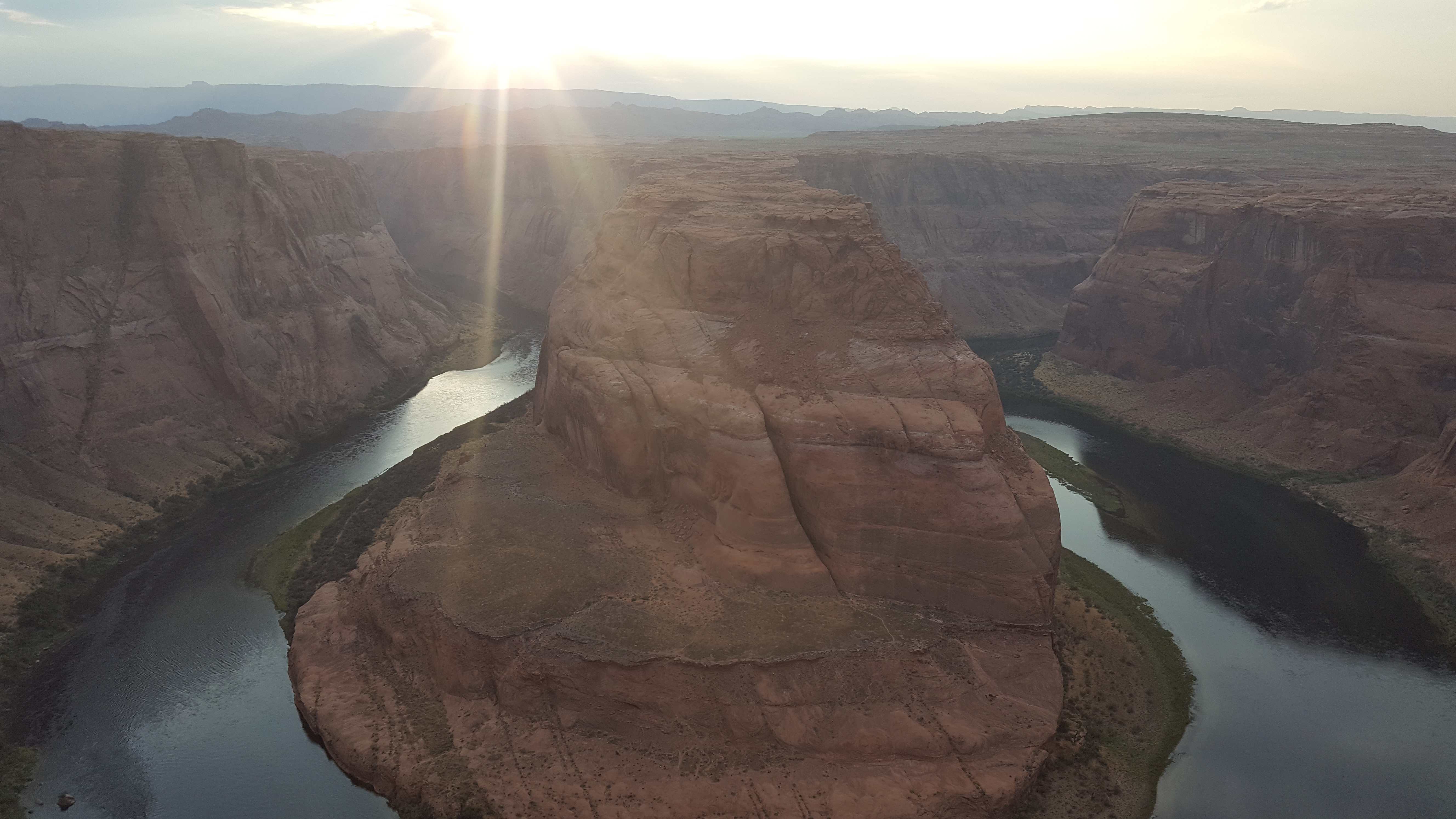
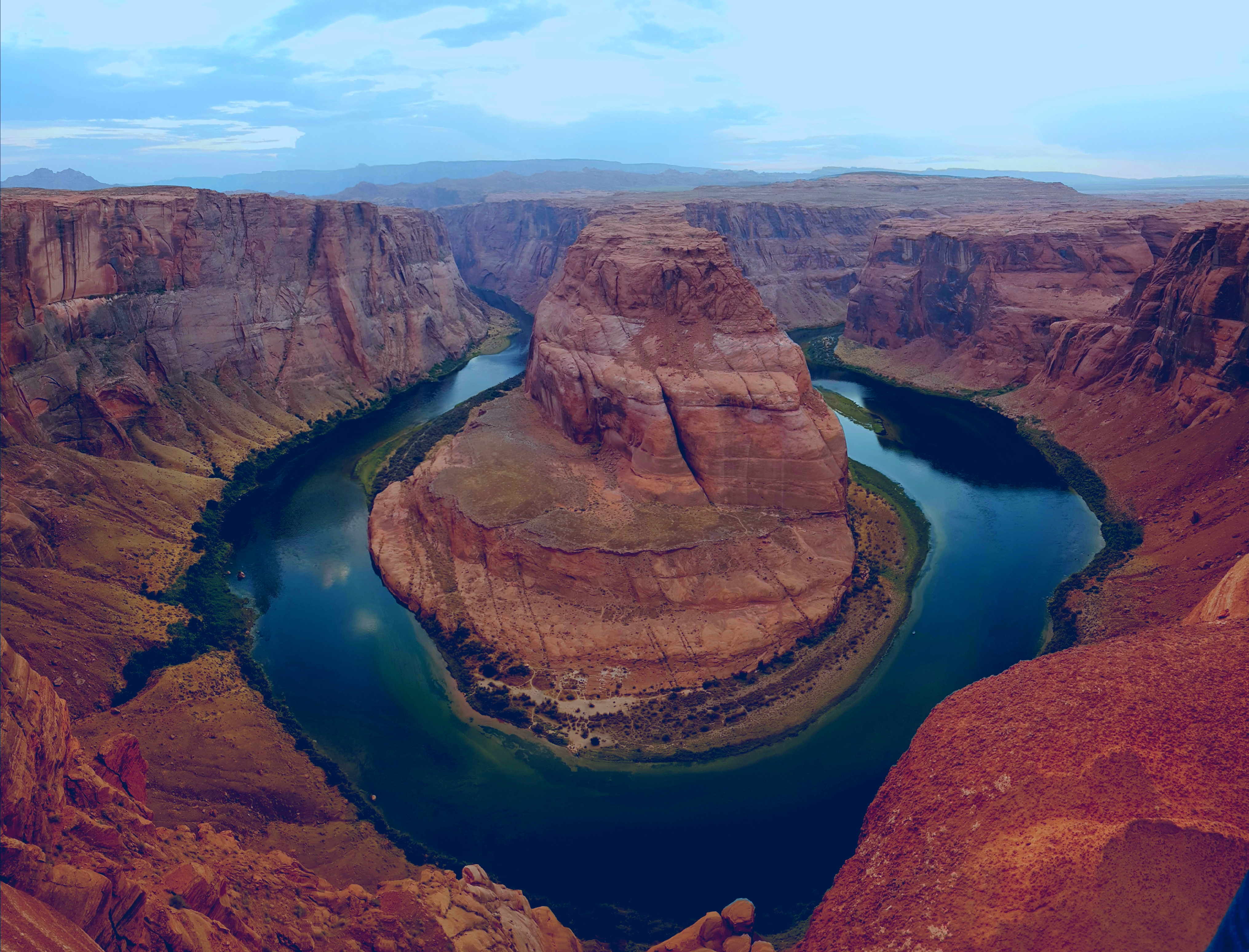
After we finished we wanted to go to Horseshoe Bend, but we grabbed a bite to eat at Dam Bar and Grill in Page. Tevin suggested going to Horseshoe Bend when the sun was setting. He said it makes it much a better time to go. We listened to him and good thing we did. The view of the Colorado River in the sunset was amazing! We took some pictures and headed out to Marble Canyon Lodge for the night.
We finished the day with roughly 310 miles. It was another great day. I still cannot get over the rock formations from Moab all the way to Marble Canyon. It was absolutely gorgeous!
Butt Pain Meter: 2/10 (Stopping often and to walk around helps a lot)